
Digital Elevation Models
Highly Accurate Global Elevation Data
Accurately conduct land use and risk assessment analysis.
Whether you are doing line-of-sight analysis, hydrological modeling, satellite imagery orthorectification, ingeniSPACE DEMs support a wide range of applications.

ingeniSPACE DEM products are available in two forms
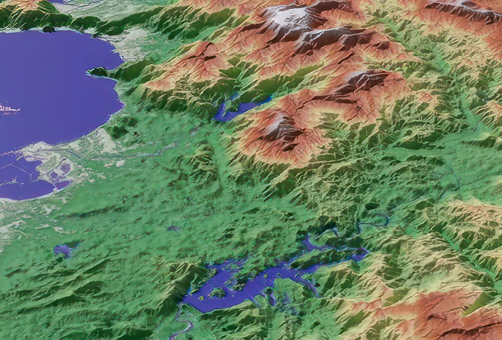
Digital Surface Model (DSM):
Represents the surface of the Earth, including buildings, infrastructure, and vegetation, refined with edited terrain features and assured hydrological consistency.
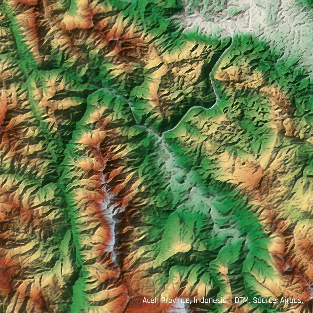
Digital Terrain Models (DTM):
Represents the bare terrain of the Earth’s surface with vegetation and man-made objects removed. Terrain characteristics such as ridge lines (e.g., mountain crests) and break lines (e.g., open mine pits) are preserved.
Advantages and Key Features

Coverage
Homogeneous, seamless pole-to-pole coverage at the same resolution and accuracy.

Resolution and Accuracy
For civilian applications, up to 5m pixel spacing for every spot on Earth. Very high vertical accuracy (2m relative / 2.5m absolute). If your mission has unique requirements contact us.

Always Up-To-Date
Data acquisition within the last three years.

Data Supplementation and Validation
Find or confirm deviations in existing topographical maps and validate land surveys.

Off-The-Shelf Availability
Available today.

DEM Applications Include
Transport and Urban planning
Elevation, slope analysis, and land feature data help determine suitable areas for various development types and transportation infrastructure routes. DEMs assist in analyzing drainage patterns, assessing the visual impact of proposed buildings, and identifying areas at risk of flooding or other climate change impacts.
This information is valuable in designing resilient cities, railways, and roads that can withstand and adapt to these challenges.

Develop Infrastructure in Complex Terrain
DEMs play a crucial role in overcoming planning and development challenges in areas encompassing mountains, forests, and rivers by offering detailed 3D terrain representations.
Facilitate the assessment of site feasibility and the creation of development plans for infrastructure projects like hydropower, as well as identify locations with unobstructed line-of-sight and minimal obstacles.

Landslide Susceptibility and Risk Mapping
DEMs can be used to map areas that are susceptible to landslides. Calculate slope, aspect, and other terrain parameters that are known to be associated with landslides.
Overlaid with other data layers, such as land cover and soil type, DEMs can help identify areas at risk of landslides.

Flood Modeling and Risk Assessment
Use DEMs to create digital flood models and simulate water flow during a flood. Predict the extent of flooding, identify at-risk areas, and assess flooding impact on infrastructure and property.
Assess flood risk in a particular area by combining flood modeling with information about the area's characteristics, such as the type of land cover, the slope and elevation of the terrain, and the presence of rivers and streams.